5:30 AM
I drove through fog wisping up from the pavement, alone on Rte. 28, headed to the Adirondacks for a day in the woods. I’d been looking forward to a long hike since last fall, when I’d climbed the Whiteface trail with a couple of friends. That had been my first time out since a back injury in May 2017 scared me into staying home. I fell out of shape, then got it back with help from a Peloton bike/fitness regimen. The ’18 Whiteface hike got me excited, and I started to think about a second attempt at the Great Range Traverse as a “turning 50” challenge. (It’s a marathon runner’s optimism that leaps from “I’m done hiking” to “I want to do 25 miles and 10 peaks in a day.”)
7:50 AM
I parked across from the Ampersand trailhead on Rte. 3 between Tupper Lake and Saranac. The sun was already high, and a single jeep was in the pull-off. I adjusted my gaiters and cinched the bug net over my head. Pack on, hiking poles, start the tracker on the new inReach Mini I’d gotten to ease my family’s concerns about solo hiking – it drops a breadcrumb on an Internet map every ten minutes, and allows satellite communication if needed.
I’d climbed Ampersand several times when I was 15, as a kitchen worker at Young Life’s Saranac summer camp; the student campers would climb the mountain each week and we’d provide a picnic lunch about halfway up the trail. I had no memory of the summit, and just a vague recollection about the picnic site.
Although I couldn’t remember particulars of those trips, the sensory reality of being in the northern New York forest was an immediate balm: morning sun dappling through the tree canopy, the heady smell of pine and earth, the giddy cacophony of rushing water increasing as traffic sounds faded. This was my favorite place to be.
I was carrying just under 16 pounds in my pack, my lightest load in a long time. Until I turned twenty, I’d run up and down the Adirondack mountains in sneakers and not much else. As an adult, I started packing for every possibility, very heavy insurance policies that were rarely called on. I’d considered this year’s pack carefully over the winter, concerned mainly about protecting my back, and whittled it down in my basement over the past month. Three liters of water was the heaviest line item, and least negotiable. I also carried two water filtration options, and would eventually consume almost 5 liters over 11 hours.
8:30 AM
I came upon a large bedrock shelf not far from a wide spot in the creek, and had a vision of 200 brown paper bags set out next to 10-gallon McDonald’s drink dispensers. We’d carry the lunches in the empty coolers, then fill the coolers from the stream, add iodine to disinfect and Kool Aid powder to mask the chemical taste. There was enough room in the clearing for a large group to spread out without impeding other hikers. My sense of the ghostly crowd was an ironic counterpoint to the moment – I’d only seen one other hiker so far, on his way down the trail. (It was probably Jeep Guy – he was dressed like I was, long khaki pants and sleeves, plus bug net.)
I remembered that our old lunch spot marked the point where the real climbing began, and that was accurate. The trail over the next 1.5 miles was steeper and more strenuous than I expected – somehow “church camp outing suitable for large groups of teenagers” had caused me to mentally categorize this as an easy jaunt. Later as I descended, I met a woman who appeared to be in her late-60s to mid-70s – a type of obviously competent, happy outdoors-person I’d like to be someday. As we chatted for a moment, I said “It’s been 35 years since I hiked this mountain – it’s steeper than I remember.” She replied, “I hike this mountain once a month. It’s steeper than I remember, too!”
My first mistake of the trip…I’d mixed seven scoops of powered energy/electrolyte drink in my 3-liter water bladder the night before. The mix had settled. When I took my first sip from the bite valve, I got a mouthful of syrupy sludge that I promptly expelled – I thought I’d never drink HEED again. I jumped up and down, hoping to agitate the bladder in my pack. A few more mouthfuls that I again spit out, and I decided to wait until I was at the summit to deal with the problem. In the meantime, no hydration.
9:40 AM
After some steep climbing, the trail leveled a bit and wound counter clockwise. I crouched underneath a slanted rock passageway, and from there it was a short jaunt to the summit. Yellow blazes marked the path to the bare rock summit, which is a surprisingly large area. I still had no memory of climbing this far as a teenager, although I must have done it at least once.
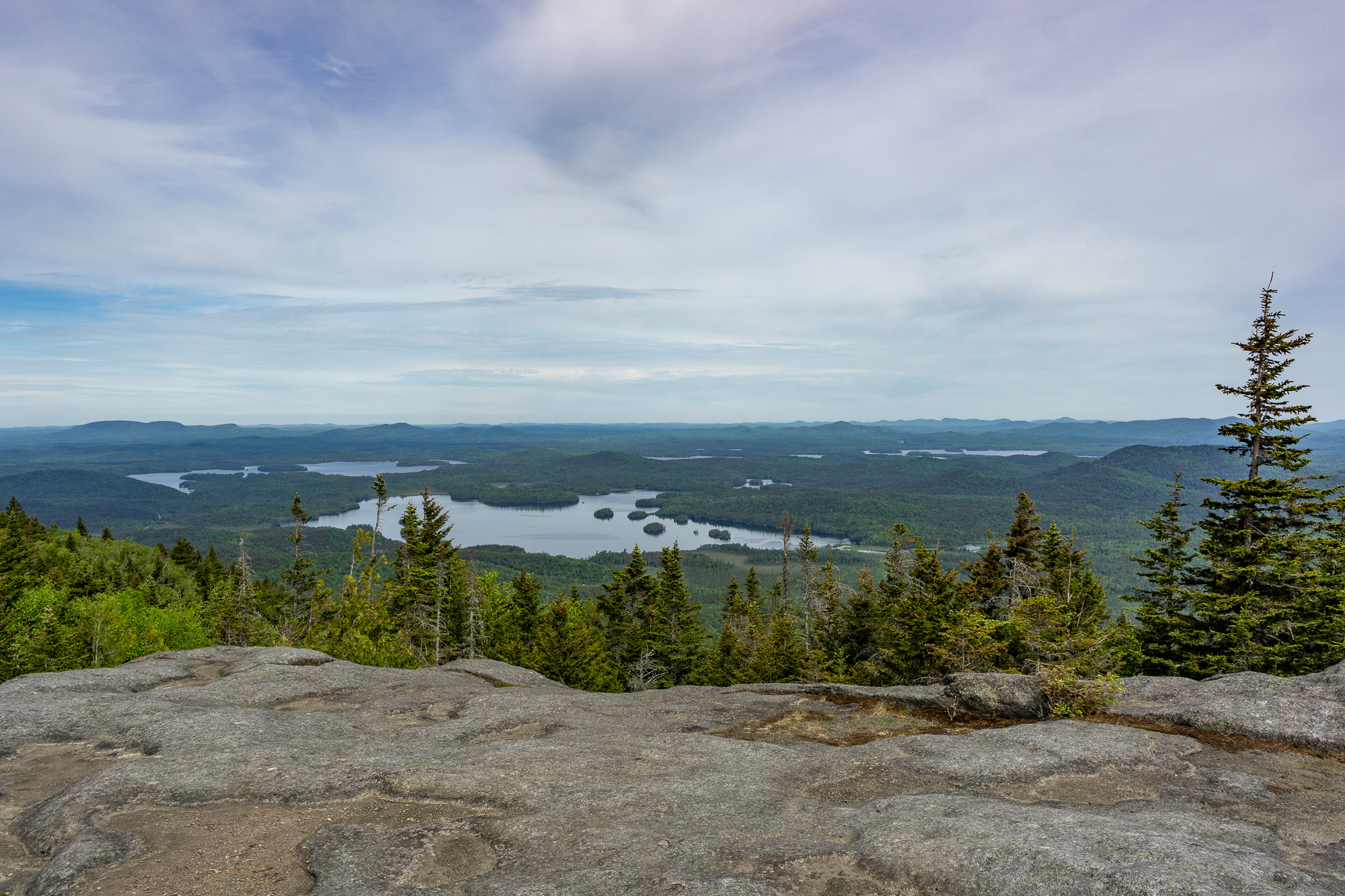
The views were outstanding – the Saranac Lakes to the north, high peaks to the southeast. The breeze was insistent, causing me to cinch the drawstring on my hat; my sweaty shirt was dry in minutes. I removed the 3-liter bladder from my pack and shook it until the HEED was again suspended through the liquid, then I cleared the hose and had a long drink.
After just five minutes on the summit, I headed back down the path. The descent was fun and easy. Except for a brief conversation with only the second person I came across, I didn’t stop until I emerged at 11:00.
11:42 AM
I drove to the next trailhead, eating an energy bar on the way. Traffic was delayed by road construction, but the sun was shining and it still felt early. I found the Haystack Mountain trailhead on Rte. 86 easily; there were five or six vehicles parked. I hoisted my pack and walked to the trail register: two other solo hikers were doing both Haystack and McKenzie, the rest planned on just Haystack. I set off on the path, which was wide and comfortable, mostly dirt covered with leaves. After a long, gradual incline, my Adirondack Explorer guidebook promised I’d see a foundation on the right at 2.2 miles; that corresponded exactly with the Garmin’s mileage track.
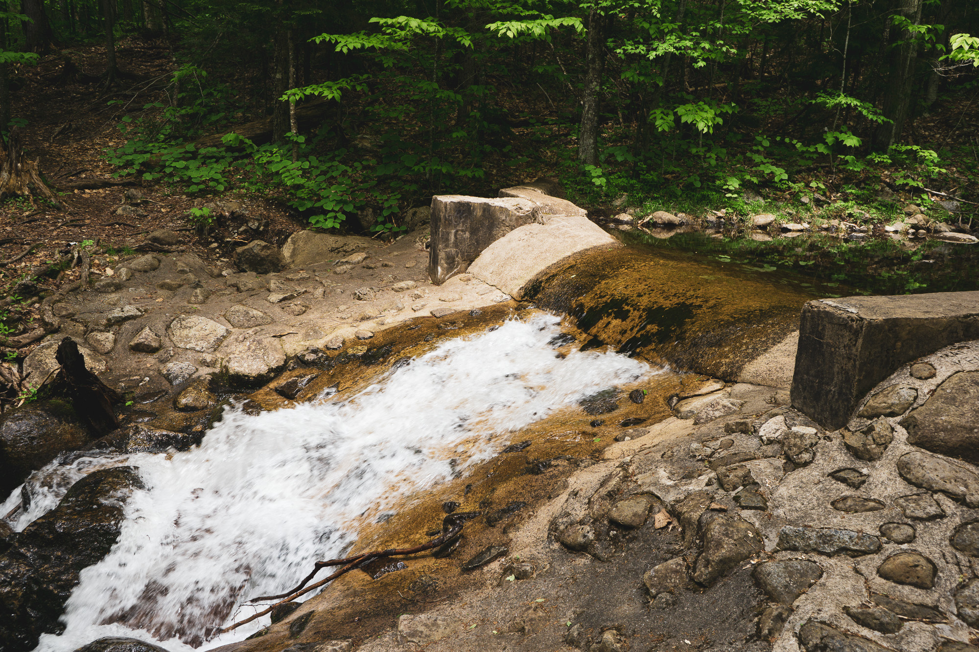
I stopped at the spillway dam on Little Ray Brook and filled a 1-liter collapsible bottle, attached a Sawyer Micro Squeeze filter and drank half the bottle directly from the filter’s push cap – cold and delicious. I topped off the bottle and shouldered my pack again. A brown dachshund ran up, then jumped back as I stood. His group was on its way back from Haystack, the people dressed in shorts, sandals, and tank tops. The young woman said “You’ve got the right idea. The bugs are deadly today.” The contrast in our outfits was comical – me with a bug net over my hat, salmon-hued long-sleeved Columbia fishing shirt, long hiking pants tucked into gaiters, thick wool socks, and Altra trail runners. The only exposed skin was my hands, and I had gloves ready if needed.
The guidebook promised “strenuous climbing” after the dam, and that was also right. Haystack’s last mile or so involves spotting a trail marker fifty feet ahead and way above you, scrambling up to it, pausing to recover breath, then repeat. There’s a lookout just below the summit – it invited me but I knew I’d have a rest soon.
1:40 PM
The top of Haystack is unassuming, but the view is a pretty spectacular 270-degree panorama of high peaks; Big Burn Mountain is immediately adjacent, seemingly close enough to leap to (with a running start). I sat on a boulder and took off my pack. Even with the breeze in the open, mosquitos still pestered my netting en masse. I took a few pictures and sent a “Reached the peak!” message via the inReach. Another hiker emerged behind me, said hello, and sat down. He didn’t have a bug net, and was quickly driven back to the return trail – I don’t think he spent three minutes on the summit.
I was concerned about the gathering clouds. Rain worried me only because it would make the rocks slippery on McKenzie; my real fear was the possibility of lightning. I’d seen (and heard) lightning strike nearby when I was on top of Gothics once before, and that had been enough to ensure an enduring conservatism regarding my place in nature. If I heard thunder, I’d end the afternoon’s hike and head downhill as quickly as possible.
The guidebook said to walk northeast from the summit until an opening in the brush indicated the beginning of an unmarked trail down the backside of Haystack. That turned out to be my favorite meander of the day – the path wound to and fro on a thick bed of pine needles, headed gently down with no scrambling, often between trees just wide enough for my shoulders. As herd trails go, it was absolutely clear where to walk, yet the path had little of the erosion and mud bogs seen on the (more heavily trafficked) marked routes that day. After just 20 minutes, I reached the Jackrabbit ski trail. The intersection with the marked trail to McKenzie was only another 7 minutes.
2:16 PM
McKenzie was my last planned summit of the day, and it was 1.7 miles away. Leaving the Jackrabbit trail, the first thirty minutes weren’t too bad. When the climbing started, it was the most intense yet – like a greatest hits of Ampersand and Haystack, only twice as long and at a point when I was becoming fatigued. I sipped frequently from my bite valve, and started chewing Perpetuem Solids (an ultra marathon fuel that provides complex carbs and protein in ideal proportion for continued activity) every thirty minutes. My progress slowed to just 3/4 mph.
I encountered both of the dual-peak trekkers who’d signed in before me. The first was in shorts and a t-shirt, bleeding from what I assumed were several black fly bites along his hairline. I asked how his day was going, and he answered in a thick Eastern European accent “The day is fine. Just a little warm for me.” I came across the second man 30 minutes later, wearing long pants, short sleeves, sandals (why do people wear sandals on these trips?), no pack, and carrying only a very large, very heavy 35 mm camera around his neck. Our conversation was limited to a quick hello – I was winded and he wanted to get down.
After an hour or so, the foliage thinned and the trees grew shorter, and I felt like the summit was close. I came to a lookout, and wondered what the nearby peak to the northeast might be – it seemed too close to be Moose Mountain…uh oh. The Adirondack Explorer guidebook hadn’t mentioned a false summit. I pulled out my waterproof ADK map and confirmed my sinking feeling – I’d have to cross over the first peak, descend sixty feet or so, then head over and climb back up to finish. It wouldn’t have been a big deal a couple of hours ago, but I was getting cranky.
On the other hand, the down and up were objectively fun – it reminded me of the cols on the Great Range, which seemed dangerously steep until you were right there and could spot each step as you went along. It was also nice to have the short level stretch between the slopes as a quick reprieve.
3:52 PM
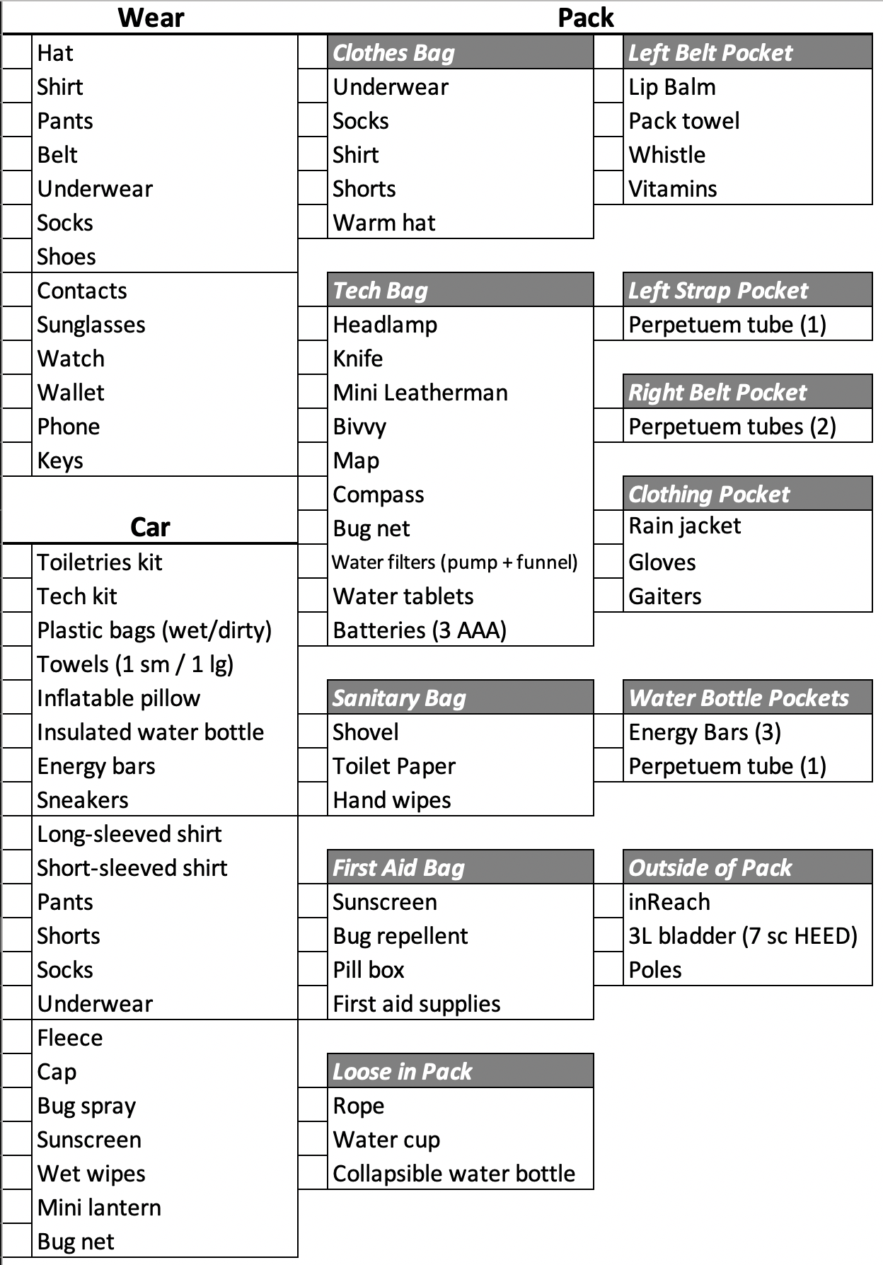
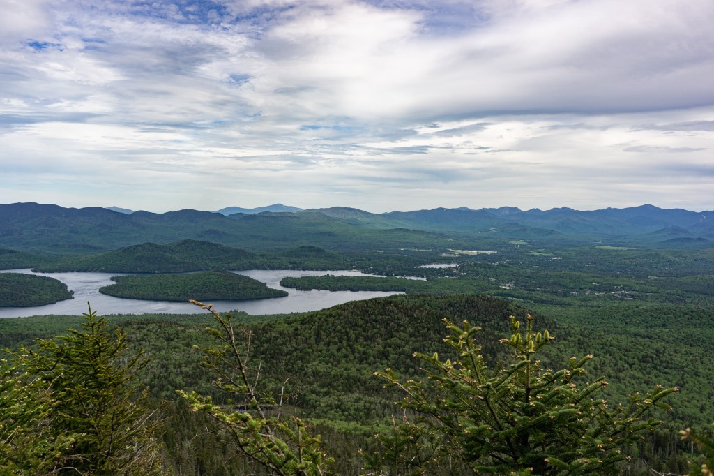
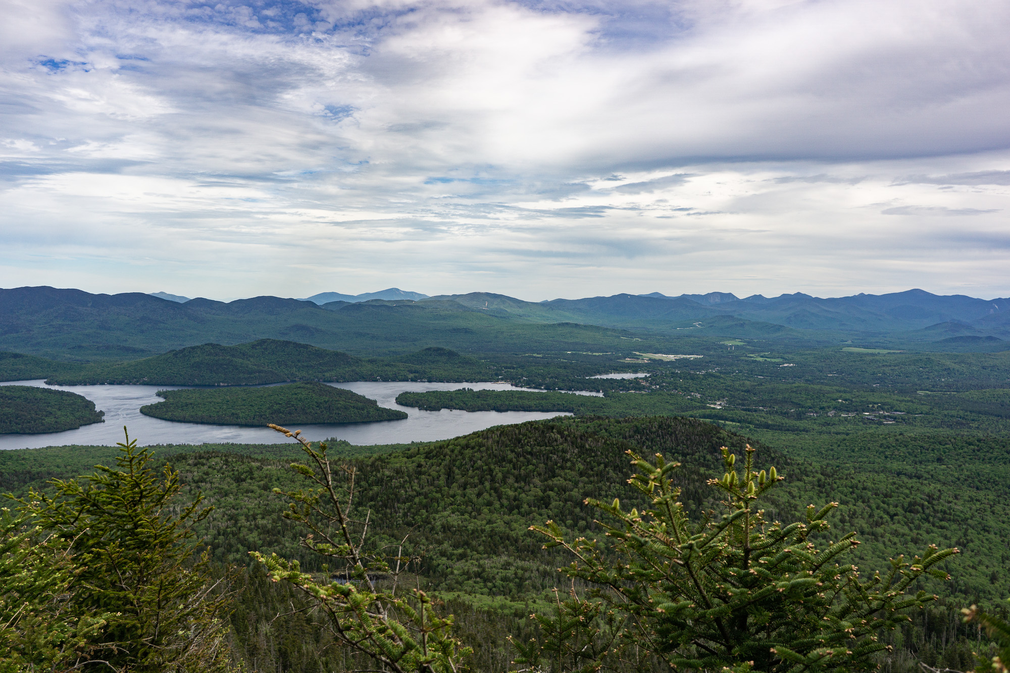
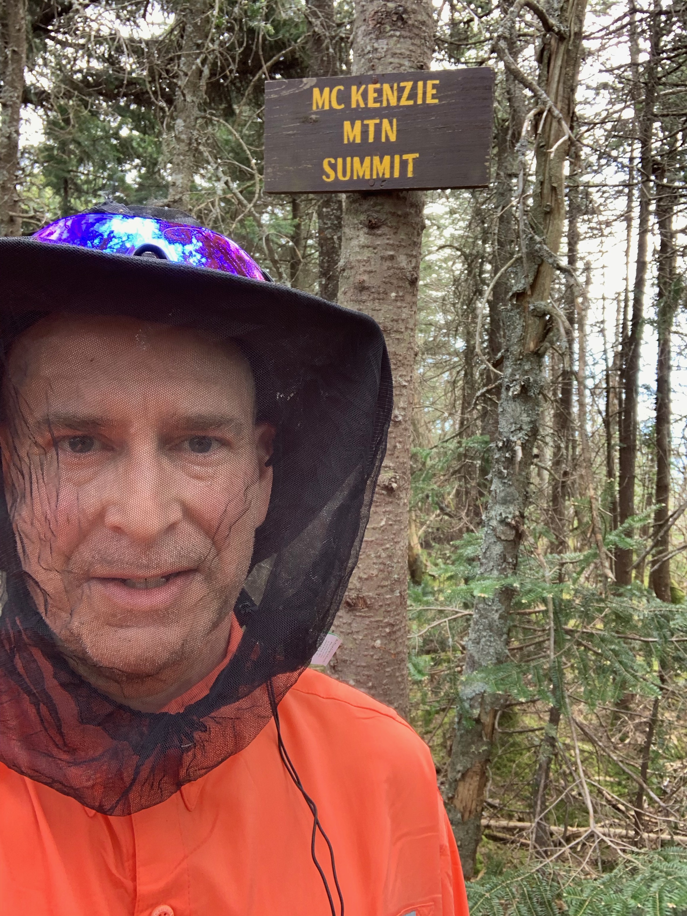
I finally summited McKenzie and took a selfie under the sign on the wooded summit. Almost 8 hours into the trip, with a 5.3 mile return still to go, and I was washed in an emotional mix of satisfaction, gratefulness, relief, and a touch of euphoria – the delicious endorphin cocktail that comes after trying and achieving something difficult. I took a few pictures from the lookout near the summit: Lake Placid immediately below to the east, its village on Mirror Lake, the Olympic ski jumps standing iconically before what seemed an endless assortment of mountains, representing both past and future adventures.
I started down, and my steps and breathing came easily. The milestones that had come with such effort earlier seemed to pass rapidly now, although I wasn’t in a hurry anymore. It started raining around 6:00, a pleasant sprinkle by the time it got through the leaf canopy. At 6:15, I arrived at the junction with the Haystack trail, about the same time a solo hiker was emerging. Shorts, t-shirt, sneakers with no socks, and no pack. We said hello, he said he was doing well. I passed him, then he passed me again and I didn’t see him again until I emerged from the woods at 7:20 and saw his taillights pulling away.
7:30 PM
I changed my clothes in the increasing rain, last in the parking area. Cleaned up with baby wipes, applied deodorant. Despite my small (for me) daypack, I was still the most equipped and extensively dressed person I’d seen that day. Had I brought too much? On the other hand, I’d been comfortable: protected from bugs, feet blister-free, and carrying a certain amount of insurance for myself and anyone else who might’ve needed it. I’d remained well hydrated and had energy left. Best of all, my back felt great. I made a few notes for what to modify next time.
Dinner and a beer at Big Slide Brewery – beer never tastes better than after intense exercise (also the concept behind the Utica Boilermaker 15K, which finishes at a brewery.) Three hours to home, and the rain continued the entire time. It was a great day.
Peaks: Ampersand (3352′), Haystack Mountain (2787′), McKenzie (3861′)
16.97 miles, 10 hours 43 minutes on the trails
Guidebook: 12 Short Hikes Near Lake Placid, by Phil Brown.
Packing list: