

I know the instant I lost my nerve. Sometimes it’s not so clear, the moment when things change from “go” to “no.” Once I quit a marathon just over 21 miles in, following 8 miles of steadily increasing foot pain; my desire leaked until there wasn’t enough left to keep me moving. On June 24, 2013 at 2:26 pm I had just summited Gothics mountain, the tenth highest peak in NY, in the middle of the Great Range of the Adirondacks and my sixth peak of the day. It was muggy and warm, except on the peaks, where the winds gusted around 40 mph. Isolated thunderstorms had been forecast, but so far I’d just heard distant rumbles off behind the haze. As I approached the top of Gothics, a hard rain came quickly, driven sideways by the wind. My next waypoint was Saddleback mountain, but first I had to navigate the southwest face of Gothics, which is notorious for its steep, bare face and fixed ropes. As I hurried down the open ridge trail, I saw to my right a bright finger of lighting touch what might have been Gooseberry mountain, perhaps a mile to the northwest and considerably lower than I was. That’s when I lost it.
When I was a child I didn’t worry about lightning. We used to tent in the Adirondacks every summer and didn’t think twice about the inevitable storms, some of them wonderfully fierce and bright. With lightning, ignorance is surely bliss; my adult perspective screams that we should have taken refuge in the car until the danger passed. During our trips we often ventured to the high peaks, more often than not Algonquin, which I knew so comfortably that it seemed like a playground. Weather reports never concerned me (although my parents might have balked at a hike with guaranteed rain.) Even as an adult I continued climbing Algonquin in all weather, including one memorable trip in the midst of a snowstorm above 4000′, which magically transformed back to a mid-50’s autumnal day as I returned down the trail.
I’m not a great athlete but I like to attempt difficult things. This is what led me to run my first marathon at 31, and my first 50-mile race nine years after that. It’s why I added a second major when I attended college in my 30’s while working full time. Maxim: if it’s hard, it’s worth doing. The journey builds character and the achievement is permanent; in an adult world where a boss can fire you, or a judge can give your money to someone else, there’s something powerful about setting personal goals and accomplishing them.
I’d long had an idea to try a weeklong solo hiking trip in the Adirondacks. Not content with just hiking, I wanted to stand on top of the mountains, where I’d always felt such awe (one of the few life experiences worthy of that overused adjective.) I’d done overnight backpacking trips before, but I hadn’t been happy with those experiences – call it investing in my learning curve. (My first time out, I carried a pack that weighed almost 40 pounds.) I’d also been on solo mountain day hikes, which I’d found quite enjoyable. Two people on a trail can be heard from a long way off (the noise increases with number and is inversely proportional to age.) People are compelled to speak to one another. Solo hikers always seemed more relaxed to me, and I’d certainly found that to be true of myself.
I spent months planning my excursion, years if you count the less successful overnighters that taught me to use different methods and equipment. I’d read about the Great Range Traverse, which Backpacker magazine calls “the third most difficult day hike in America.” The GRT is roughly a 25-mile loop of ten Adirondack mountains with 17,600 feet of elevation change. I figured if it’s a very hard single day hike, I should be able to do it in two days. This seemed reasonable to me because, 1) I could run marathons; 2) I’d lost 30 pounds during the spring, which was the weight target I’d set for my pack; 3) I’d climbed Algonquin many times, which is the second highest mountain in New York state and is rated as “difficult” by most authorities. For the remainder of my trip I’d tackle a few remote peaks with unmarked trails. I planned a week off from work and made lists and itineraries and triple-checked everything (unusual for me; I tend to pack five minutes before leaving on most trips.)
I camped overnight Sunday at the NYS Sharp Bridge campground, just north of Schroon Lake and less than six miles from the trailhead. I arrived and departed in the semi dark, and for all I knew I was the only person there (I’d registered and paid online) but it seemed like a nice place. Quiet. In the morning I had a quick breakfast and repacked my tent.
I parked at the Rooster Comb trailhead in Keene and was on the trail by 6:00 am. The air was thick with the kind of humidity that wilted paper, but otherwise it looked like a great day ahead, with minimal chance of “isolated thunderstorms.” I took comfort in the word “isolated,” because I figured even if a storm happened, it probably wouldn’t affect me. Right.
I arrived at the summit of Rooster Comb at 7:27 am, having dropped my pack at a spur .4/mile before. My only physical concern leading up to the hike had been a strange pain in my left hip/pelvis area that had kept me from running for the previous two weeks; it felt fine after 1770′ of climbing, so I figured all systems were go. I was sweating in the heat but I had 66 oz of water (the heaviest thing I was carrying, about 15% of the pack’s overall weight) and a purifying kit, plus I’d been training all spring to run in a semi-dehydrated state anyway.
The summit of Rooster Comb features a stunning panorama looking south on the Great Range, with a 180-degree panoramic view and a vertiginous drop onto the pine forest below. I’d never experienced vertigo in the Adirondacks until peering over that cliff; it wasn’t the last time I’d feel that way over the next twelve hours.
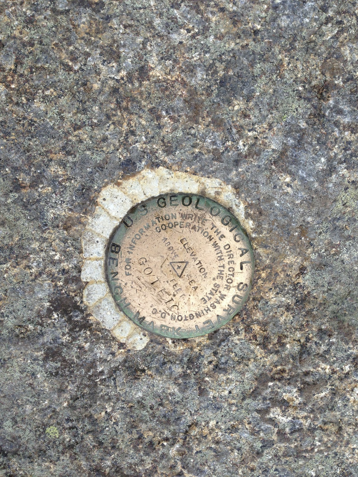
Up and over Hedgehog at 8:29 am (unexciting) and finally my first official High Peak of the day, Lower Wolf Jaw (#30, 4175′) at 10:10 am. Or thereabouts. I couldn’t find a sign to commemorate the summit, and I spent about 25 minutes wandering around, using my GPS at maximum zoom as if searching for a stubborn geocache. I’m convinced I was at the highest point on Lower Wolf Jaw (which was 25′ off the official trail), but I have no smiling picture of myself in front of a sign, let alone an embedded U.S. Geological Survey marker to show for my trouble. I’d consumed about 12 ounces of water, and had little appetite for the snacks I’d packed. I was also realizing that losing 30 pounds is not quite a zero-sum trade with a 30-pound backpack, at least not when climbing over boulders and fallen trees and assorted rock faces over almost 4000′ of ascent. Theory and reality are inconsistent at 82 degrees and rising.
Another difficulty was that the humidity made most rock surfaces greasy. I was testing my steps before committing but even so found myself sliding far too often. This slowed my progress and gave my arms an extra workout as my excellent hiking poles saved me from falling every few minutes.
Upper Wolf Jaw (#29, 4185′) came at 12:05 pm, and some of the haze around the mountains had become identifiable clouds. Some of those were dark, and rumbling could be heard, although I didn’t see any flashes. I was starting to drink more now and this was troubling because I knew that by the time one feels thirsty, you’re too far behind on hydration to catch up quickly. Although my muscles still worked easily I had no desire for food; also, my feet were rubbing in their boots from all of the lateral sliding, and I knew that blisters were forming.
I hadn’t seen another person on the trail, which had to be a record for me. When I say that I like to hike by myself, I always add, “you’re never alone in the Adirondacks.” I was used to encountering dozens of people on the trails; of course, I’d never been on these particular trails, and I’d rarely hiked on a weekday. As I ascended Armstrong, I came upon my first fellow hikers; I’d just climbed a 20′ fixed ladder and was looking up at another 30′ of vertical ascent over narrow diagonal edges. Coming down at the same time was an evidently French Canadian couple. The man had a dog on a leash, which looked to be a pointer of some kind. Because he needed both hands to secure himself, the man unleashed his dog, which scampered down and past me. It paused briefly at the top of the ladder, looked back at his master and then walked down, head-first. He sat at the bottom, waiting for them to catch up.
I summited Armstrong (#22, 4400′) at 1:34 pm and met two women there who had come from Gothics. We chatted about the weather and they thought I should hurry, because “you don’t want to be going down Gothics in the rain.” As it turns out, they were right.
I’d barely stopped to enjoy any summit, let alone marvel at the fact that I’d now climbed five mountains in just over seven hours. There was no peace looking out on creation today – the mountaintops were windy, hostile places that offered views of dark clouds approaching. The slopes were hot, slippery, treacherous paths; I’d fallen half a dozen times now and my pants were soaked with sweat and mud. I had about 22 ounces of water left and three peaks before I expected to find more.
On my way between Armstrong and Gothics I came across a family of five, the children aged between 10-15 with nothing but sneakers on their feet and not even a bottle of water in hand. They seemed entirely unfazed by the miles they’d come nor worried about what was ahead. They were having fun. That used to be me. I climbed over yet another false summit on the way to Gothics (this trail had many false summits) and marveled at how .25 miles (a lap around the track!) could take 45 minutes when every footfall had to be tested and every step was either “boulder, branch or bog.”
Gothics (4736′) may be the single most stunning summit I’ve ever been on, but I was in no position to enjoy it as the rain whipped my face. Algonquin and Marcy have broad, rocky summits that reward exploration and seem to pose no danger of falling off; Gothics seems to jut up from everything around it. Falling off seemed possible. Then I saw the lightning strike, heard that terrifying crack almost instantly, and I wanted nothing more than to be in a different place.
I realized then why so many people like Disney World. Disney makes every possible effort to make you feel safe. They create an artificial world full of interesting things that pose no threat at all. Even marathons, while difficult to complete, are pretty safe, with water stations every couple of miles and medical personnel standing by to help in case of emergency or even extreme discomfort. The Adirondack mountains are served by countless volunteers who clear trails, build ladders and bridges, and rig ropes to allow weekend warriors to come and play. But for the first time ever on one of my Adirondack adventures, I was acutely aware that I WAS NOT SAFE. I don’t mean safety as in comfort; I mean safety as in considering your chances of not dying as something over 99%.
I ran down the exposed ridge of Gothics toward the southwest face, hunched in a ridiculous crouch that seemed to offer a less inviting target for lightning (stupid, I know, but maybe if struck I would have been that much closer to the ground.) I wondered briefly what my 10 year-old self might have made of this – would I have been delighted? The path was marked with paint stripes on the bare rock, which was great because my head was down. The slide was ahead, and that’s what I did – I slid on my behind right down the rock. I’d stowed my hiking poles earlier because they get in the way while scrambling, so I made good progress crab-walking/sliding down the bald face. Suddenly my empty water bottle popped from its holster on my left side – I made a diving grab before it tumbled away, and at that exact moment I wondered what a fool I must look to an observer. Idiots get caught in thunder showers on the top of mountains; I was definitely in the club.
I reached the first rope, which happened to be the first fixed rope I’d ever seen while hiking. There was an eye bolt embedded in the rock, with rubber-covered aircraft cable running away down the face as far as I could see. I grabbed on and was surprised to feel some give to the rubber – it was slick from rain but I could feel a tacky resilience that assured me I wouldn’t slide out of control as long as I could hold on. I turned around and backed down the slope, hand over hand and foot behind foot. There were several of these ropes going for maybe a few hundred feet, and they always ended about ten feet shy of where I wanted to be – those last feet were another butt slide. At one point, I misjudged the slack in a cable and stood, expecting resistance. With nothing to stop me, I tumbled backward, cable in hand, and might have begun a series of backward summersaults if I’d let go. I didn’t, but I was feeling banged up and stupid.
From the col between Gothics and Saddleback I looked back up and saw blue sky; the mountain was steep but its character had changed to something less terrifying. If Gothics is famous for its ropes and slides, Saddleback is surely underrated for steepness. According to cnyhiking.com, “The trail as you ascend toward Saddleback has a very steep section which includes one crazy rock scramble that may not be suitable for everyone. There are numerous open sections of trail which include walks next to dangerous cliffs. Care should be taken while hiking to this peak, especially those continuing to Basin Mountain.” Understatement.
Saddleback’s summit ridge consists of two peaks, with a .2 mile dip between them (less than once around the track!) that took me almost 30 minutes to complete. I reached the higher summit (#17, 4515′) at 4:05 pm, and celebrated with 8 oz of water. My mouth was too dry to chew food, so I abandoned an attempt at a granola bar. Again, the wind was fierce although the sky remained friendly; nevertheless I kept thinking I heard thunder.

Looking from Saddleback toward Basin, the peaks seem remarkably close. There is a profound col between them, and this stretch ended up constituting the most difficult hiking I’ve ever done. I stood from my brief rest and shouldered my pack, and immediately lost my footing and fell flat on my side. I resituated myself and moved just a few dozen feet down the bare rock trail when I came to a cliff, with a yellow painted arrow pointing clearly over the edge. “You’ve got to be kidding me…” For years I’ve carried a 50′ length of cord in my pack, which has never been used except as a clothesline after I’ve returned home. When I was cutting pack weight during preparation I’d considered leaving the cord (8 oz) behind. I tied the cord and lowered the pack to the next ledge, turned on my stomach and performed some inelegant slithering maneuvers that managed to get me down in one (somewhat scraped up) piece. And repeat.
Just about halfway between Saddleback and Basin, on the only trail, I encountered two French-accented women. They asked how to get back to John’s Brook Lodge, and I asked if they had a map (duh.) We looked at mine and I showed them the only way back to the Lodge involved going over Saddleback, or back over Basin, where they’d come from. Neither of these choices looked appealing to them, and I knew why: neither of their day packs could have held much water to begin with, let alone emergency supplies. One turned to the other and said, “I am so sorry I didn’t know the right way.” I was alone and thankful I didn’t have to apologize to someone for almost getting them killed.
The most difficult steps I’d taken yet that day were those first few up Basin. I’m sure this was exacerbated by fatigue and dehydration, but I knew already that I’d lost my nerve; my desire to go back up was gone. Unfortunately, my choices were the same as I’d given the women: either direction meant up.
My next trial was self-inflicted. Before I started up, I stepped off the trail to relieve myself. I didn’t have spare water for cleaning my hands, and I’d overlooked the fact that I’d just reapplied bug repellant. It turns out that certain parts of the body should never come into contact with bug repellant. I was seized with intense burning that became worse as my underwear chafed, and no repositioning could relieve the sharp pain.
I renamed both Saddleback and Basin that afternoon with the prefix “fucking,” and I expect I’ll always think of them that way. According to summitpost.org, “[Basin is] not a traverse you would want to do with backpacks…” (I feel compelled to point out that the official ADK Guide suggests making the Traverse an overnighter; also, every sign at every trailhead throughout the region recommends hiking with water, extra clothing, food, bivy sack and pad… hard to do without a backpack.) For as many times as I roped my pack down sections of Saddleback, now I had to haul it up Basin in the same manner. After yet another false summit heartbreak, I finally reached the actual peak (#9, 4827′) at 5:55 pm.
I finished all but 6 oz of my water and called Susan, as I finally had phone coverage at this elevation. I hadn’t been able to check in as much as might have reassured her, although we both know cell phones are unreliable in the region. My throat was ragged from dryness and my voice sounded thin. I left out mention of my “isolated thunderstorm” and sent her a picture of where I’d been. I told her my plan was to descend Basin, find water and set up camp. As I spoke to her, the summit winds were still blowing 30-40 mph, and I noticed a Winnie-the-Pooh dark cloud floating toward me from the southwest. It seems irrational but I was certain the cloud had seen me, and had purposely decided to come for me. The sound of wind in my ears seemed to be hiding the sound of thunder, and again I just wanted to descend.
The southern trail down Basin isn’t as steep as the path to Saddleback, but there was a lot of water coming down the rocks from the day’s rain. I didn’t fall again, but every step had to be laboriously checked and required considerable effort. My cloud seemed to hesitate as I dropped back into the forest, and then it seemed to lose interest in me, and veered north. The evening would have been absolutely pleasant if I hadn’t been soaked and parched and on the fagged side of scared.
At the bottom of Basin there is an intersection that offers a shortcut path across Slant Rock for a little over a mile, with a lean-to at the far end. Lean-to sites often have designated camping areas close by, and they are usually near good water sources, so I drank the rest of my water and made the turn around 7:00 pm. Unfortunately, Slant Rock is a minor mountain itself (3593′), and the path took me up and around the summit before heading back down again. Also unfortunate was the fact that no trail condition updates magically appeared on my ADK map – I encountered three large blowdowns that required significant time to navigate around in the waning light.
Water is a huge component in the body. Dehydration symptoms become noticeable after 2% of normal bodily water volume is lost. Initially, one experiences thirst and discomfort, along with loss of appetite. Athletes suffer loss of performance and lose endurance. Other symptoms also include irritability, headache, dry mouth and dizziness. I’ve run dehydrated many times, and finished two marathons in a state of what I’d call advanced dehydration. Thoughts of beverages begin to consume your thoughts, even (especially) beverages that won’t particularly restore balance: sodas, milkshakes, beer, coffee, scotch. Most of my favorite foods are in the beverage category. I had food poisoning once and received 2.5 units of IV fluid – on the trail I began to fantasize about that IV. Decision making suffers as dehydration persists, and one also discovers that happy thoughts require moisture.
I turned on my headlamp and decided I couldn’t wait for flowing water and found a deep puddle that was fed by a trickle from a few feet above. I filtered and purified 16 oz and immediately gulped it down. The nasty thing about dehydration is that your desire for water exceeds your ability to process it; you get bloated and feel sick from drinking too much at once, and you still want more. Fighting off an increasingly bold swarm of mosquitos I stocked up all of my containers and set off again, refreshed in my desire to reach the lean-to.
Lean-tos are almost always accompanied by a nearby outhouse, though I’ve only attempted to use one once (and I’ve only been lowered head-first into one once, for which I thank that highly moral and upright organization, Boy Scouts USA.) Wilderness toilets are different than the ubiquitous race-day port-a-johns that runners, fair-goers and construction workers have a love/hate relationship with, with their peculiar gag-inducing chemical smell. Those chemicals do something important though: they keep bugs away. In a remote outhouse, the flies grow huge and they react violently when assaulted from above. Luckily, I hadn’t eaten so I didn’t have much need for a toilet, and I probably would have followed the off-trail trench method in any case.
Now that I was beginning to rehydrate (the process would end up taking two days), fatigue became my main concern. Travel on the path (boulders, branches and bogs) using my headlamp was painfully slow. At-large camping is prohibited above 4000′ and it’s discouraged above 3500′, but I was safely below that elevation by now. Tents should be located 200′ off the trail, on a hard surface (to avoid damaging the flora.) It’s surprising how few suitable spots there are in the high peaks area – solid, level ground is rare.
In the twilight I saw what looked like a beautiful clearing off to my right. I ventured off the trail and over several downed trees, then found myself plunging down through the leaf and moss-covered ground. I grabbed an upright tree and stopped my fall while only my upper torso remained above; there was nothing solid to stand on or to step back out of the hole, and I had visions of plunging into Wonderland. A buggy, slimy, mossy Wonderland. Using only my arms I dragged myself up and out, and found my way back to the trail, ever so fucking carefully. Finally, after another 10 minutes I spotted an area only 20′ off the trail, just big enough for my 22 sq. ft. tent.
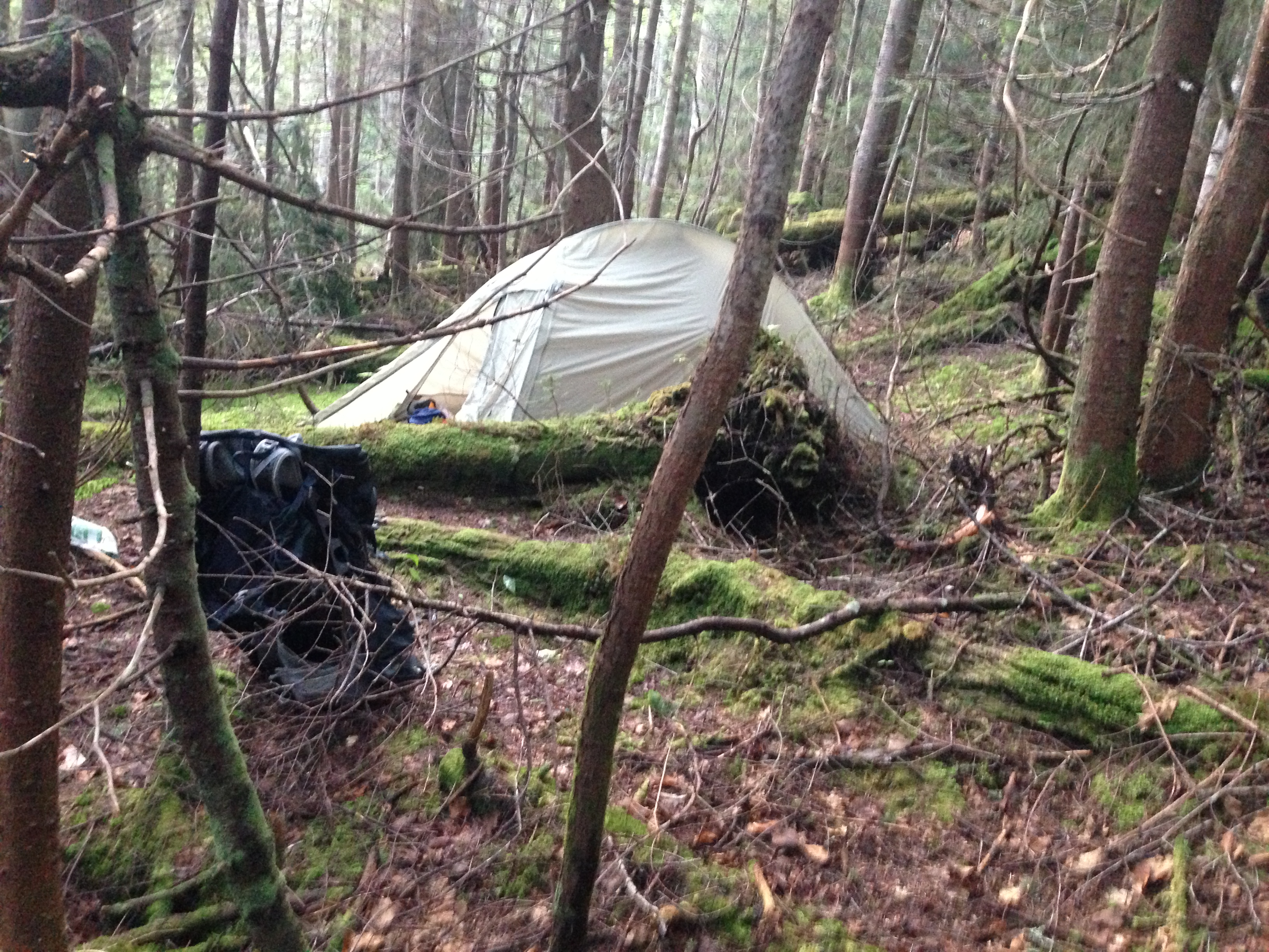
I was too tired to eat but I could hear the brook I was heading for. As it turned out, I was only 100′ from the intersection I’d been seeking, and only 400′ from the lean-to. I stowed my bear canister the recommended 100′ from my tent (actually 50′, as it turned out.) At 9:05 pm, just 15 hours after I’d started the day’s hike, I lay on top of my sleeping bag, watching the final light wane from the sky. I stripped off my sodden clothes and felt little but failure – no relief, no pleasure, no anticipation for the following day. (As it turns out, happy thoughts are lagging indicators of hydration.)
If it’s hard, it’s worth doing. I still believe that. But right now I wonder when I’ll be ready to climb back up those mountains. I put the total at 8-1/2 mountains for the day, 6 of those high peaks. But I’d been oh-so-humbled by the experience, and felt little joy in the accomplishment.
